
Did you know that half of the fatal crashes that happen in Columbus involve a pedestrian, bicyclist, or motorcyclist? Therefore, Vision Zero Columbus is on a mission to end crash-related fatalities. “By equipping those who use the city’s transportation system with knowledge and awareness to build safer habits—whether they are driving, walking, or riding a bicycle or motorcycle—Vision Zero is creating more equitable mobility in Columbus.” Take a look at how Carpenter Marty aided the City with Livingston Avenue.
Location
As a part of the Vision Zero Movement and as a subconsultant to NBBJ Design, Carpenter Marty Transportation was tasked with completing the engineering assignments related to the study. The Livingston area bordering Berwick and Bexley, and bookended by Driving Park and Eastmoor, encompasses the north and south side of Livingston Avenue from Alum Creek to Kenwick Road. Over 750 crashes occurred in the area from 2017-2020. CM has reviewed, summarized, and analyzed all crash data. CM collected vehicle, pedestrian, and bicycle turning movement count data at each of the five signalized intersections encompassed in the study area.
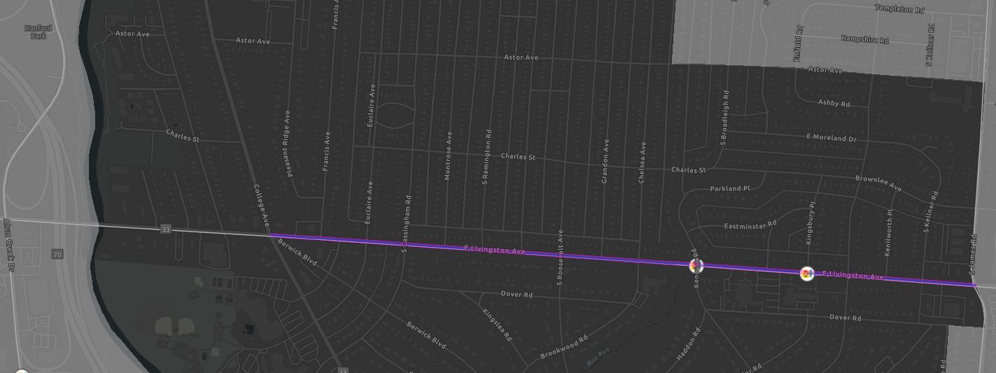
The commercial section of the corridor is primarily located between Alum Creek Drive and College Avenue, with current use in this area including service and convenience-oriented retail along Livingston Avenue; institutional uses; multifamily residential; and parkland. Leading to a variety of challenges that exist and make it difficult for substantial redevelopment and improvement to occur within the East Livingston Area of Bexley and Berwick. On the other hand, this area presents a tremendous opportunity for two neighboring communities to unite behind a common vision for improvements to the corridor, bringing renewed value to the area that provides meaningful physical and cultural connectivity, and enhancements to pedestrian, cyclist, motorist, and public safety. The City of Bexley and the City of Columbus desired to partner on a planning project to identify opportunities for improvements to the corridor that would benefit the residents of all surrounding communities.
Improvements
The Cities of Bexley and Columbus have worked jointly through a public process to provide a Berwick and Bexley Livingston Avenue Plan, in order to provide for safe and accessible infrastructure, attractive streetscape, and cooperative development and land use policies in the corridor focused on revitalizing the corridor and surrounding neighborhoods of Bexley, Berwick, Eastmoor, and Driving Park.
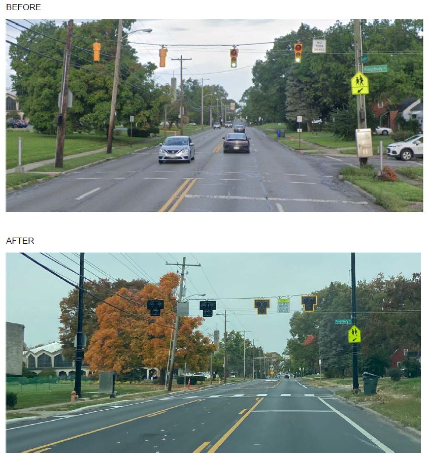
As a part of Carpenter Marty’s tasks associated with the study recommended improvements were provided. The City of Columbus quickly mobilized to implement the recommended improvement of a road diet in a portion of the study area. As a result, Livingston Avenue from College Avenue to James Road was resurfaced and changed from two lanes in each direction to one lane in each direction plus a center turn lane, with new median islands and crosswalk markings.

Another important improvement area to note is the intersection of Kingsbury Place and Livingston Avenue. Crosswalk and intersection improvements were also completed. For example, at Kingsbury Place, ladder-style crosswalk markings were added, and an old single-phase signal was upgraded to a Pedestrian Hybrid Beacon. These combined changes will encourage safe speeds and reduce crashes.
If you would like to read more about what the City of Columbus is doing with Vision Zero Columbus, you can read the full action plan and stay updated on their progress on their website, located here.

Previous Article
Employee Highlight: Shane KalinoskiNext Article
Toast to the New Year!
One thought on “Joint Livingston Avenue Plan”
mplrs.com
January 18, 2023 at 10:13 amThanks for the great article!
Comments are closed.